|
Place Year Type of disaster N. affected people |
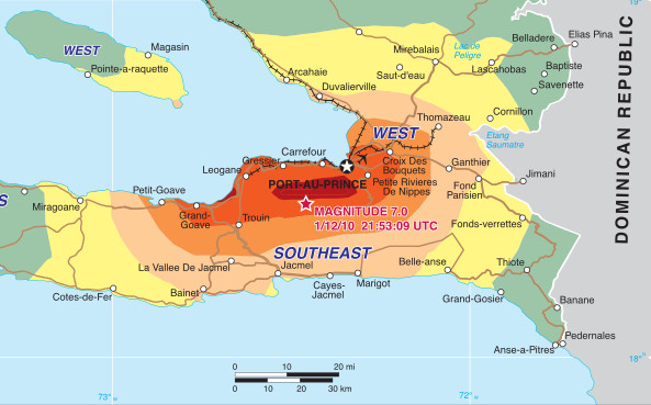
Haiti (America) 2010 Earthquake 2 million |
 |
|
Brief description: A devastating 7.0 magnitude earthquake affected Haiti’s most densely populated urban areas. |
||
|
Mission: To distribute 150 tons of aid with a maximum budget of $80,000 (USD). |
||
|
Network: The transportation network is composed of three nodes with available humanitarian aid (port, airport and Jimani city at the border with Dominican Republic), twelve transshipment nodes and nine demand nodes, which total 24 nodes and 42 arcs. |
||
|
Data: Available here. |
||
|
Data sources: The network data come from a logistics map provided by the United Nations Office for the Coordination of Humanitarian Affairs (OCHA) (as of January 31, 2010). The map includes the location of the supply nodes, the distribution sites or demand nodes (both secured by the US Joint Task Force and the United Nations Stabilization Mission in Haiti – MINUSTAH) and most of the transshipment nodes. The demand at each distribution site is estimated from a map showing the density of displaced people and field medical locations as of January 26, 2010. Data regarding the characteristics and conditions of the road infrastructure are from two maps:
|
||
|
Tested in: The case is tested in (1), (2), (3) and (4). The first article introduces an improved version of the model presented in (5), which is based on static network flow. The second article introduces a double dynamic network flow. Both articles propose goal programming models. The third article presents a hierarchical compromise model for the joint optimization of recovery operations and distribution of emergency goods, and the fourth article develops a GRASP method to solve the routing problem.
|
||